01 — A shortcut becomes a nation
The Lachine Canal exists because of a stretch of water it was built to avoid. The Lachine Rapids, just west of the island, had blocked ocean-going ships from Montréal to the Great Lakes since the French regime — hence the name, a rueful nod to explorers who once hoped this route led to China. Opened in 1825 after four years of digging by Irish and French-Canadian labourers, the canal let cargo bypass the rapids via seven locks between the Old Port and Lachine, 14.5 km upstream.
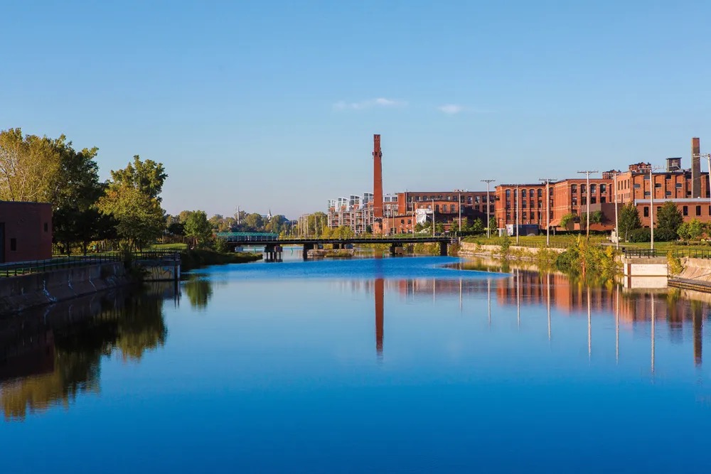
Within decades it stopped being a bypass and became a magnet. Flour mills, sugar refineries, textile plants and foundries lined its banks to tap the free hydraulic power of the locks — Redpath Sugar, Merchants Manufacturing, the Belding-Corticelli silk works. By 1871 the corridor produced roughly a third of Québec's industrial output. Historians now call it, without much exaggeration, the cradle of Canadian industrialisation: the country's first sustained experiment in factory labour, worked-class housing and organised unions, all crowded onto one narrow ditch of water.
“A visible and tangible testament to the industrial history of Canada.”Parks Canada, on the Lachine Canal's 1996 National Historic Site designation
02 — Silence, then a second life
The 1959 opening of the St. Lawrence Seaway made the canal's shallow locks obsolete for modern freighters overnight. Traffic thinned through the 1960s and the last industrial user shut down in 1970, leaving 14.5 km of stagnant water and abandoned mills that Montréal spent a generation deciding what to do with. Parks Canada took over the corridor, and in 1996 the federal government designated it a National Historic Site — official recognition that the rust belt was also a heritage site.
The real transformation came with money: roughly $80 million from the city and Ottawa, alongside private redevelopment of the old factories into lofts and offices, funded a full re-watering and relocking of the canal. It reopened to pleasure boating in 2002, and the towpath that once hauled barges became a bike path that, in 2009, Time magazine ranked among the ten best urban cycling routes anywhere. Locals will tell you it's the best one, full stop — flat, uninterrupted, and lined with exactly the kind of industrial-to-artisanal texture this city does better than most.
03 — What lines the water now
Ride west from the Old Port and the canal narrates its own history: Griffintown's converted foundries, the murals under the Atwater Tunnel, then the Art Deco silhouette of Atwater Market, which has sold produce from the same 1933 hall since it replaced the old Saint-Antoine market. Its clock tower is the unofficial kilometre marker for everyone on two wheels — turn off here for oysters, cheese, or a baguette to eat trailside.
Keep going into Saint-Henri and Côte-Saint-Paul and the old warehouses have become breweries, and this is deliberate: Messorem Bracitorium, at 2233 rue Pitt, brews out of a converted industrial building two blocks off the water — the kind of stop that only makes sense once you understand what the canal used to manufacture. The path ends, fittingly, at Parc René-Lévesque in Lachine, a former shipping jetty now carrying 22 large-scale sculptures from symposiums held between 1985 and 1994 — an industrial spit reclaimed twice over, first by nature, then by art.
.jpg?width=1600)